Winter Weather Update: Snow Moving Out, But the Cold is Just Beginning
After a long stretch of winter weather, the snow is finally on its way out. Forecasters say the system will gradually move from west to east, with the last flakes falling late tonight. While the snowfall is winding down, road conditions will remain hazardous as temperatures plunge, creating slick and icy spots for drivers.
When Will the Snow Stop?
Meteorologists predict that snowfall will begin tapering off in the western parts of the region first, then move eastward throughout the evening. By midnight, most areas should be dry, though a few lingering flurries may stick around.
Skies will start to clear overnight, but the coldest air of the season will rush in behind the system. This will lead to freezing conditions, increasing the risk of black ice on untreated roads.
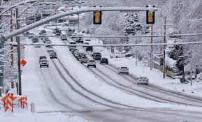
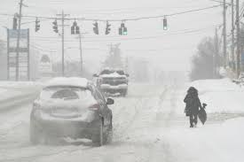
Road Conditions & Travel Hazards
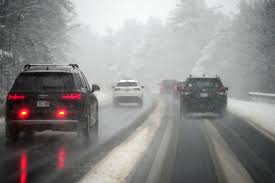
Even though the snow is coming to an end, travel will remain dangerous in many areas. Snow-covered and icy roads could make for treacherous driving conditions, especially on bridges, overpasses, and less-travelled roads.
Road crews are actively working to clear highways and major streets, but residential roads may stay snow-packed into the morning. If you must drive, allow extra time, reduce speed, and be cautious of refreezing.
What’s Next?
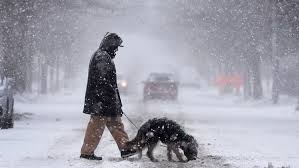
As the snow exits, an Arctic blast will bring some of the coldest temperatures of the season. Overnight lows will drop into the single digits and teens, and wind chills will make it feel even colder. Any wet or slushy roads will refreeze overnight, leading to a high risk of black ice for morning commuters.
Looking ahead, another potential winter system is on the horizon later this week. While the snow may be ending for now, winter is far from over. Stay tuned for updates and bundle up as the deep freeze settles in.